[ i ] Parallax section below. Click on the section below to upload image. Don't worry if it looks weird in the Weebly editor. It'll look normal on your published site.
To edit or delete your image, press the "toggle" button below. Then, hover over your image until a popup appears with the "edit" and "delete" options. If you don't want a white content section, leave it blank. It will disappear on your live website.
The Value of Riparian Vegetation
(originally published on the King County website)
Stream or river banks are riparian areas, and the plants that grow there are called riparian vegetation. Riparian vegetation is extremely important because of the many functions it serves.
Bank stabilization and water quality protection
The roots of riparian trees and shrubs help hold streambanks in place, preventing erosion. Riparian vegetation also traps sediment and pollutants, helping keep the water clean.
Fish habitat
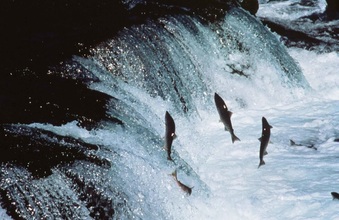
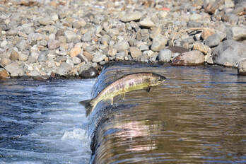
As dying or uprooted trees fall into the stream, their trunks, root wads, and branches slow the flow of water. Large snags create fish habitat by forming pools and riffles in the stream. Riffles are shallow gravelly sections of the stream where water runs faster. Many of the aquatic insects that salmon eat live in riffles. Salmon also require riffles for spawning. They use pools for resting, rearing and refuge from summer drought and winter cold.
Wildlife habitat
Over 80 percent of all wildlife species in western Washington use riparian areas during some part of their life cycle. Riparian vegetation provides food, nesting, and hiding places for these animals. Unfortunately, forested riparian areas account for the smallest percentage of forest land in Washington.
Food chain support
Salmon and trout, during the freshwater stage of their life cycle, eat mainly aquatic insects. Aquatic insects spend most of their life in water. They feed on leaves and woody material such as logs, stumps and branches that fall into the water from streambanks. Standing riparian vegetation is habitat for other insects that sometimes drop into the water, providing another food source for fish.
Thermal cover
Riparian vegetation shields streams and rivers from summer and winter temperature extremes that may be very stressful, or even fatal, to fish and other aquatic life. The cover of leaves and branches brings welcome shade, ensuring that the stream temperature remains cool in the summer and moderate in the winter. Cooler, shaded streams have less algae and are able to hold more dissolved oxygen, which fish need to breathe.
Flood control
During high stream flows, riparian vegetation slows and dissipates floodwaters. This prevents erosion that damages fish spawning areas and aquatic insect habitats.
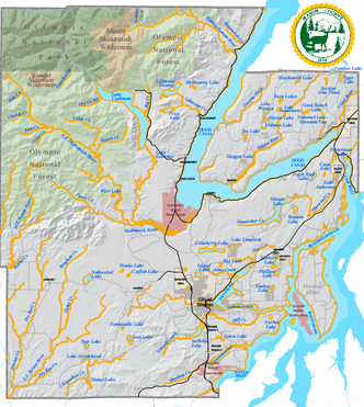
Mason County's Rivers, Creeks & Streams
List of Rivers, Creeks & Streams in Mason County
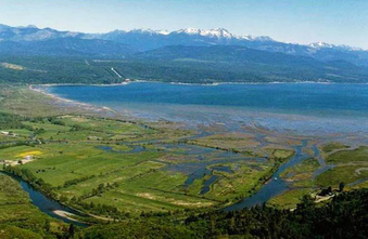
There are 35 watercourses in Mason County which fall under the Shoreline Management Act. This page on the Washington State Legislature website lists all 35 along with their legal descriptions.
Mason County Shoreline Inventory and Characterization Report
This report describes existing conditions within the Mason County shorelines and provides a map folio based upon Geographic Information System (GIS) data. The report describes existing land uses, such as residential uses, parks, development and water-dependent industries. It also evaluates existing natural shoreline processes and functions, such as forested riparian areas, wetlands, wildlife habitat and fish present. The inventory report identifies areas suitable for restoration and additional public access.
|
Mason Conservation District
450 W Business Park RD Shelton, WA 98584 Phone: (360) 427-9436 Fax: (360) 427-4396 |
|

